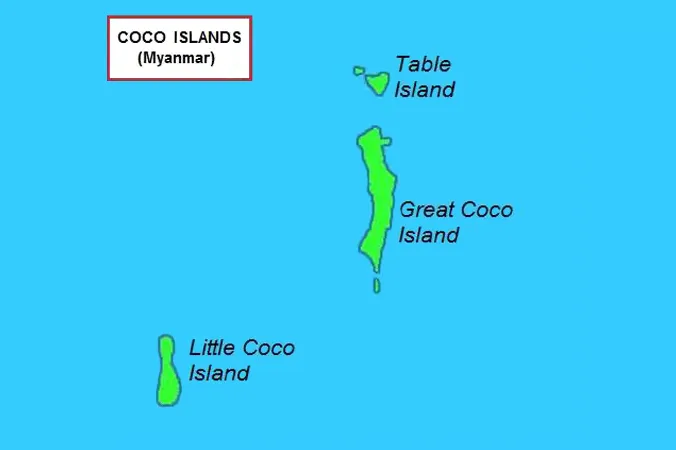
The Bay of Bengal and the Andaman Sea are as important to Myanmar as they are to India. Most sea lines of communication (SLOCs) pass through these two seas. The Coco Island north of Andamans is strategically important to both India and Myanmar. China has shown keen interest in this island since last four decades. It is supposed to have a SIGINT facility to monitor Indian missile launches into Bay of Bengal and Indian Ocean. The airstrip too is considered a Chinese construction. The Myanmar coast line is dubbed by many as China’s second coast in the IOR.
Recently a spurt of activities has been witnessed at the Coco Island. Considering Chinese ambitions in the IOR and its assiduous expansionism, there is a strong need to monitor all activities in the IOR especially at the Coco Island. We made an effort to read the Myanmar activities in the island through Google Earth (GE) satellite imagery of the last one year.
Reclamation
Myanmar has actively reclaimed an area of 400m X 900m for possible expansion of the airstrip. A large cement mixing plant has been established to construct cement blocks for reclamation as well as construction and expansion of the pier (discussed in succeeding para). Very large quantities of tetra-pods have been dumped for possible strengthening of coastline. A 470m long and 7m thick retaining wall has been constructed at the Northern end of the airstrip.

Airstrip expansion
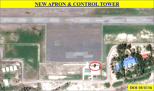
The airstrip at the Coco Island has been expanded over the last decade from 1300m to 1800m to 2000m to the present 2300m. The land reclamation suggests that it is likely to be extended to 2500m with a 200m overrun at both ends. The additional 1000m in Southern end has been carved out of the adjoining hill. The excavated earth probably been used for reclamation purposes. The apron has been constructed between 2006- 2013. It has now been expanded to a size of 125m X 180m. A control tower has been erected along with a reception building.

New naval pier
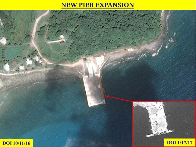
A large naval pier (size 100m X 55m) is being constructed at the north eastern end of the Coco Island. It is assessed that this pier will be used for unloading infrastructure related materials. Both sides of the pier will probably have at least two cranes each sooner than later.
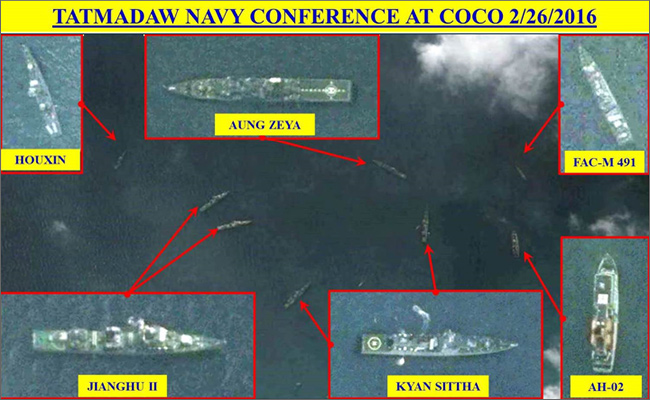
February last year saw a large naval presence here during the “Sea Shield 2016” bilateral naval exercise with India. Five frigates, a stealth ship, an FAC missile and a hospital ship are observed at the new pier on February 26, 2016. Four of the frigates, the stealth ship and the hospital ship are indigenously constructed at Yangon Naval Construction Yard. The construction is being largely assisted by China especially the C-802 missiles on board these frigates. This naval exercise was considered part of India’s “Act East Policy” in which the present government also has sanctioned a radar station at the Narcondam Island.
Radar station
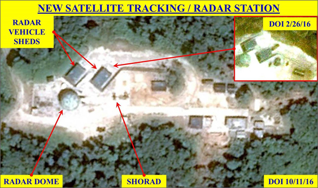
A new radar station has been constructed at the highest point of the Coco Island at about 91m above sea level. The station has a radome of 11.5m diameter probably containing main radar. It also has two vehicle sheds (size 11m X 6.5m) for radar vehicles to park. There is a platform (size 15m X 15m) West of the radome for deployment of radar vehicles. At least three SHORAD guns are observed at this radar station. The construction of this radar station had started in 2014 end. The design suggests Chinese origin/assistance.
Worrying development
New infrastructure development and expansion/renovations of existing infrastructures in the Coco Islands is a worrying development. The large airstrip that can land military aircrafts and a radar station that can monitor every Indian activity from Sri Lanka to Malacca Straits, Indian interests are under careful watch if not under threat.
On the contrary, India’s reactions to these developments have been lethargic to say the least. Despite the green and government go ahead for a radar station at Narcondam Islands since last two and half years, there has been no activity at all till date.
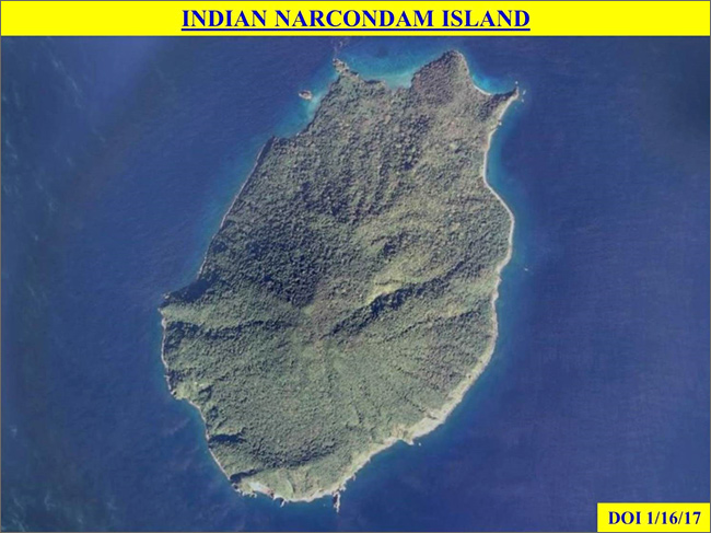
India needs to understand the strategic importance of the Andaman Sea and needs to develop the infrastructures in the Andamans to make it a strong military and economic hub in the IOR. The radar station in the Narcondam Islands also needs a push at appropriate levels.
The views expressed above belong to the author(s). ORF research and analyses now available on Telegram! Click here to access our curated content — blogs, longforms and interviews.


 PREV
PREV

