The Maldives’ recent decision to terminate an agreement with India for joint hydrographic surveys has been the subject of some controversy in the Indian media. Signed during Prime Minister Narendra Modi's visit to the islands in 2019, the pact was seen as a symbol of India-Maldives defence ties. Malé’s move came a few weeks after the island state formally asked New Delhi to withdraw its Indian military presence from its shores. As if to emphasise its reservations about defence engagement with India, Malé also skipped the latest meeting of the Colombo Security Conclave in December 2023.
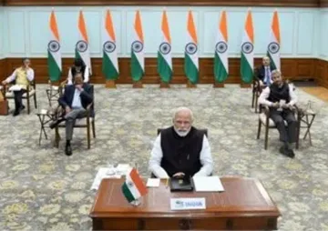
That trust between India and the Maldives is at a low ebb is readily evident. Since the election of Mohamed Muizzu as Maldivian President, there has been a deliberate, if predictable, attempt by Malé to create distance with New Delhi. Muizzu came to office on the back of an “India-out” campaign, making the slogan a key pillar of his foreign policy. The President visited Türkiyé last month, breaking a long tradition of Maldivian presidents visiting New Delhi first, a less-than-subtle signal that India ranks low in the new administration’s foreign policy priorities.
The Muizzu administration’s refusal to renew the hydrography seems less to do with the President’s sensitivities about sovereignty than with his special relationship with Beijing.
Maldives would like the world to believe it is asserting its autonomy in constrained circumstances, with regional powers—China and India—locked in competitive rivalry. It is not. Far from balancing ties with Beijing and New Delhi, as many South Asian states have wisely chosen to do, Malé has thrown in its political lot with China. The Muizzu administration’s refusal to renew the hydrography seems less to do with the President’s sensitivities about sovereignty than with his special relationship with Beijing. Getting Indian hydrographic ships out of Maldivian waters appears intended to aid China’s marine surveys of the surrounding seas.
Still, the discussion in India has missed some crucial facts. First, hydrographic data isn’t by itself benign. Marine information, like most other data, is agnostic and can be used for both civilian and military purposes. Experts say that the data that helps advance nonmilitary objectives, such as ensuring navigational safety, marine scientific research, and environmental monitoring, also facilitates military aims like surveillance of a nation’s vital coastal installations and warfighting assets.
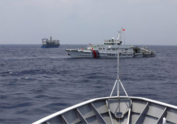
Second, China’s use of seabed surveys and marine data is intended expressly to advance a strategic agenda. The country has an expansive oceanographic research program, in which “scientific research vessels,” in particular the Shi Yan class of oceanographic survey ships, are deployed in the Indian Ocean. China also deploys the Yuan Wang series of intelligence-surveillance-reconnaissance ships in the Indian Ocean regularly. Their presence goes largely unnoticed, eclipsed by China’s growing naval footprint.
The country has an expansive oceanographic research program, in which “scientific research vessels,” in particular the Shi Yan class of oceanographic survey ships, are deployed in the Indian Ocean.
Third, and most important, marine surveys and reconnaissance, are critical enablers of the PLAN’s maritime strategy in the far seas. China's ocean surveys play an important part in enhancing China's anti-submarine warfare capabilities. The mapping of the ocean’s temperature profile and the study of other oceanic phenomena such as currents and eddies, Indian observers surmise, is meant expressly to improve sonar performance and detection of enemy submarines. It also aids in the development of systems that help Chinese submarines elude detection and fine-tune tactics for littoral combat. China’s repeated requests to Sri Lanka and Maldives last year to allow the docking of marine research ships at their ports.
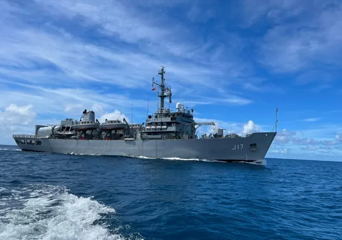
However, China's oceanographic surveys in the waters of friendly South Asian states are hampered by the presence of Indian hydrographic ships in the area. The Indian Navy can track foreign ships' subsurface sensor activity. China’s ocean scientists know Indian hydrographic operations could potentially interfere with their marine survey efforts in the waters of Indian Ocean island states.
Meanwhile, speculation abounds of a Chinese plan to develop a naval base in the Maldives. In 2018, China planned to set up an ocean observatory in Makunudhoo Atoll, North of Malé—not far from India’s Lakshadweep Islands. Maldivian opposition leaders had then expressed reservations about the observatory’s potential military applications, including a provision for a submarine base. There is no evidence that China has revived that proposal, but observers say given recent developments, the possibility cannot be discounted.
Maldivian opposition leaders had then expressed reservations about the observatory’s potential military applications, including a provision for a submarine base.
For its part, Maldives has apprehensions about India’s hydrographic activity being a form of intelligence collection. Its concerns aren’t entirely unfounded—not because Indian activity in Maldivian waters is suspect, but because the laws and legal framework governing hydrography aren’t different from the norms governing military surveys. The United Nations Convention of the Laws of the Seas (UNCLOS), does not explicitly authorise a coastal state to regulate hydrographic surveys or military surveys conducted beyond its territorial sea; a littoral state may only regulate marine scientific research in its EEZs. By implication, foreign maritime agencies conducting hydrographic surveys are free to map the seas outside a coastal state’s territorial waters. It is this prospect that Malé finds problematic.
The issue is better understood if one considers that the aim of hydrography is not to collect data about topography and geophysical processes for the sake of knowledge. Instead, it caters to a specific demand, which can come either from marine ecologists, scientists, and the maritime industry or military strategists and national security planners. That does not alter the reality that many navies, in particular the IN, have an exemplary track record of hydrographic surveys in their neighbourhoods. The IN has rendered hydrographic assistance to Mauritius since the 1990s, charting the vast Mauritian EEZs and helping build capacity, even assisting with the setting up of a hydrographic unit for skill development among Mauritian hydrographers.
Maldives would do well to look at India’s record of maritime assistance; the IN is an acknowledged first responder during regional crises and a favoured security partner for many South Asian states. Malé should know that its best bet to enhance maritime awareness and security remains a partnership with India. President Muizzu’s eagerness for a strategic concert with Beijing is driven plainly by political calculations. He should know that it is not India but China that seeks to weaponise ocean surveys. The adverse consequences of Chinese military and non-military presence in the Maldives near-seas could be severe for Malé.
Abhijit Singh is Head of the Maritime Policy Initiative at the Observer Research Foundation
The views expressed above belong to the author(s). ORF research and analyses now available on Telegram! Click here to access our curated content — blogs, longforms and interviews.