With the publication of Water: Asia’s New Battleground by commentator Brahma Chellaney in 2011, the fear that China may intervene and divert the river Brahmaputra became widespread.
His subsequent essays reinforced the idea that China is an upstream hydrohegemon whose interventions over the Yarlung (as the river is called Tibet) may have an egregious impact on downstream India and Bangladesh.
The river’s course
Recently, he wrote that “the upstream dams’ cumulative effect would likely be the extinction of most migratory fish species in the basin… could happen tomorrow to the Brahmaputra and other Tibet-originating rivers that are the target of China’s dam builders.” Here, China’s intervention on the Yarlung having a deleterious impact on downstream nations is termed the “Brahma Hypothesis”.
There are two elements of the impact of this hypothesis: Firstly, downstream Northeast India will dry out; and sediments forming and resuscitating the fertile soil of the river’s floodplains and
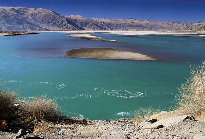
delta will be trapped in upstream constructions. Scientific data suggests otherwise. The Brahmaputra, flowing through southern Tibet, Northeast India and eastern Bangladesh, and with tributaries in Bhutan, has a length of 2,880 km. Of that, 1,625 km flows through the Tibetan plateau as the Yarlung Tsangpo, 918 km flows in India as the Siang, Dihang and Brahmaputra, and the rest of the 337 km in Bangladesh is named the Jamuna until it merges into the Padma near Goalando.
This distribution of length gives the impression that the geography around the headwaters carries the maximum flow of the river and, so, Chinese interventions can deplete the water
downstream. The Brahmaputra is identified as the flow downstream of meeting of three tributaries, the Lohit, Dibang, and Dihang, near Sadiya in Assam. The Yarlung (Dihang or Siang in
Arunachal Pradesh), the longest tributary of the Brahmaputra, is fed by snow and glacial melts, in addition to rainfall. The normalised melt index of the Brahmaputra is in the range of 0.15-0.2, signifying that snow and glacial melt, the main source of run-off in the Tibetan region, contribute negligibly to the total flow.
The precipitation varies with climate, altitude, temperature, pressure, latitude and orography, and variable interactive impacts of prevailing winds.
The annual average precipitation in the trans-Himalaya of about 300mm hardly compares with the annual average precipitation of about 4,500mm after the river crosses the Himalayan crestline. This increases the flow of the Brahmaputra in India.
Tributary flow
Further, the Brahmaputra receives large components of the flow in India and Bangladesh from tributaries like Burhi Dihing in the East to Teesta in the West.
According to Chinese scholar Jiang and colleagues, while the total annual outflow of the Yarlung in China is estimated to be about 31 billion cubic metres (BCM), the annual flow at Bahadurabad, the gauging station near the end of the sub-basin in Bangladesh, is about 606 BCM. Further, while the peak flows (June-October) at Tsela Dzong and Nuxia in Tibet are about 5,000 and 6,000
cumecs (cubic metres per second), respectively, the peak flow at Pandu (Guwahati) is approximately 60,000 cumecs. The lean season flow in Nuxia, is pegged at 500 cumecs, while the lean flow at Bahadurabad in Bangladesh is about 5,000-odd cumecs.
These figures do not support the linear algebraic thinking that the flow in a river is proportional to its length inside a country. Coming to sediment flows, it needs to be kept in mind that the flow
volume and discharge in the Yarlung are not sufficient to generate and transport the very large sediment load in downstream Brahmaputra.
The annual suspended sediment load near Nuxia in Tibet is around 30 million metric tonnes, which is miniscule compared to the 735 million MT sediment load at Bahadurabad.
China bogey
The sediment is created further downstream in India, where precipitation is almost 10-12 times higher than in rain shadow Tibet. So, from the soil formation or soil fertility perspective of the ecosystem services of sediments, upstream Chinese intervention is unlikely to have a significant impact on sediment regime in India or Bangladesh.
Further, from the demand perspective, it may be noted that despite Brahmaputra having the highest per capita renewable water availability (to the tune of 17,500m3/ person) across all Indian
rivers, barely 12 per cent of the renewable quantity could be developed and utilised for economic purposes.
While China has been planning hydropower projects, it is irrational to think that it will plan for a northward water diversion, as the energy needed to lift the water and costs to be incurred in the process will far outweigh the proposed benefits. While this article neither validates nor contests China’s intents towards downstream India, it is important to recognise that hydro-diplomacy
should be based on scientific data and informed analysis, rather than amorphous jingoistic sentiments.
This commentary originally appeared in Mail Today.
The views expressed above belong to the author(s). ORF research and analyses now available on Telegram! Click here to access our curated content — blogs, longforms and interviews.


 PREV
PREV


