High quality satellite images of the recent Australian bushfires surfaced all over the internet in late December 2019. The same phenomenon occurred when the Amazon forests were on fire in August, the same year. The images created a worldwide social impact resulting in people from all over the world urging the authorities to take action. These images came from various constellations of Earth Observation Satellites (EOS) like the Himawari-8 satellite from JAXA, NASA's Suomi-NPP satellite and the Sentinel-2 satellite by the ESA. While the images from various EOS appealed to the common folks, the other forms of climate data gathered by these satellites like heat emission, air temperature, moisture levels and wind information helped the scientific community to depict the current and future effects of the forest fire and plan accordingly. Similarly, owing to the data from EOS, the past fifteen years have provided the scientists with a more comprehensive understanding of the Earth from space than ever before. This comprehensive and detailed view from the satellites has proven to be critically important in studying how rapidly the earth’s climate is changing and its effects, both globally and locally.
Why is Earth Observation necessary today more than ever
The need for the best available scientific knowledge for an effective and progressive response to climate change has been highlighted in the Paris Agreement. The weather and climate monitoring systems present on land have limited coverage of the earth, about 30% only. Hence the knowledge and data on the climate change phenomenon is usually patchy and incomprehensive. Therefore, the need for earth observation and remote sensing has become quite important in today’s scenario in filling these knowledge gaps. A number of earth observation programs by multiple countries are in effect today. The Copernicus Climate Change Service (C3S), a program launched by various agencies in Europe including the European Space Agency, has been of vital use by providing spatial and temporal data related to various climate variables for Europe and the rest of the world. On December 18th, 1999, NASA launched ‘Terra’ satellite as a part of its Earth Observing System program which has a total of 26 satellites for monitoring the various components of the climate system. JAXA on December 23rd, 2017 launched its Global Change Observation Mission- Climate (GCOM-C) satellite which monitors constant changes in radiation budget and carbon cycle etc. by constantly conducting earth observations for long-terms which in turn gives comprehensive insights on the global warming phenomenon. Meanwhile India’s ISRO has currently thirteen operational satellites in Sun-synchronous orbit and four in Geostationary orbit to conduct Earth observation. The CARTOSAT series, RESOURCESAT, OCEANSAT, INSAT-3D are few of the many satellites which are dedicated for this purpose, providing necessary data in a diversified spatial, spectral and temporal resolutions for catering to the studies going on in the country on Earth observation and climate change studies.
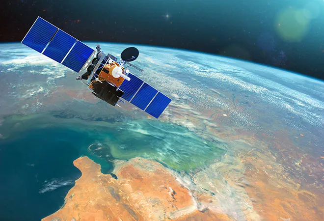
Polar or Sun-synchronous satellites go around the earth several times in a day and cover the majority of Earth’s surface several times whereas geostationary satellites are helpful in constant monitoring of a specific region under them. A viable data from constant monitoring of the macro and micro changes in the Earth’s climate, ocean circulation, carbon, energy and water cycle, albedo, cryosphere and various other parameters will help the scientific community to study the changes better and even help the governments in preparing for future calamities and plan of action. There has to be a change in the respective space policies of the countries. The focus from ex-situ space activities like outer space exploration, space mining etc. and in-situ activities like space weaponization, space defence have to be shifted to comprehensively observing the earth and gathering data to help understand and counter climate change and its effects. The leading spacefaring nations must take the necessary step to jointly contribute to developing a unified earth observation system.
Polar or Sun-synchronous satellites go around the earth several times in a day and cover the majority of Earth’s surface several times whereas geostationary satellites are helpful in constant monitoring of a specific region under them
What changes should be done? Focal areas.
Nations must pursue a cooperative agenda for observing the Earth and studying climate change, and a number of strategies can be recommended for achieving this. The most crucial is the integration of earth observation programmes, at least among like-minded countries. Collaboration in terms of joint development and launching of these satellites to sharing and analysing data gathered can help in furthering climate change studies. Established space players with satellite launching capabilities should extend aid and assistance to developing nations which do not have this capacity, through funding as well as in data gathering and analysis. The Global Climate Observing System (GCOS), an international organization under World Meteorological Organization (WMO), rather than directly making Earth observations, facilitates the international and national space organisations to coordinate among themselves to generate the needed Earth observation data. The collaborative efforts of many spacefaring nations can contribute to gathering of data through their earth observation programmes; some of the countries are already doing it. In 2010, 54 Essential Climate Variables (ECVs) were defined by GCOS ,which are required to systematically observe Earth’s changing climate and contribute to the work of the UNFCCC and IPCC. Some of these ECVs include sea level, ocean surface heat flux, Earth radiation budget, composition of carbon dioxide, methane and carbon monoxide.
The collaborative efforts of many spacefaring nations can contribute to gathering of data through their earth observation programmes; some of the countries are already doing it. In 2010, 54 Essential Climate Variables (ECVs) were defined by GCOS ,which are required to systematically observe Earth’s changing climate
With enough Earth observation resources, there can be a dedicated monitoring of the various ECVs and of specific critical regions which are most prone to climate change. With sea levels rising by 3.3mm per year, many island nations like Kiribati, Haiti and Maldives are under the threat of getting submerged in the future. The Maplecroft’s Climate Change Vulnerability Index puts the city of Lagos at an ‘extreme’ risk with the rising sea level eroding the soil, contaminating water for agriculture and it will experience more hot days and drought due to rising temperatures owing to the location of the city. For regions at high risk due to the changing climate, a more dedicated and continuous monitoring of various climate indices should come into force. Monitoring of flood-prone areas, cities emitting high volumes of carbon, forests prone to fires during the dry season, ice caps and the polar regions should be done in a more systematic and regular manner. The present day sensors on satellites can target remote and inhospitable areas where ground observation is almost impossible and thus monitor deforestation and melting of ice caps in an efficient manner.
Challenges
The challenges to having a more enhanced EOS system are in the areas of getting international consensus in joint use of space, sharing of technology and data and finally the emerging problem of crowding of space and space junk. In 2011, the U.S. Congress passed a bill that explicitly forbids NASA to work with China in any area related to space on the grounds of high risk of espionage. The space rivalry is back again. With a growth rate of 5.75% per year in the space budgets of governments worldwide, peaking at an estimated $84.6 billion by 2025, and the increasing competition among space agencies, there seems little scope of sharing of technology. The threat of security also persists with sharing of Earth imaging technology. Countries have started to distinguish between their civil and military space operations. Japan, on the lines of the USA, announced the establishment of a Space Domain Mission Unit by 2021 under its Department of Defence. This trend of greater utilisation of space in the military and security arena indicates less cooperation and less willingness to share space technology and data in the future. The space dynamics is also slowly changing with a number of private space actors entering the sector and adding to the number of launches per year which have been growing at 8% since the past decade. The total number of launches in the year 2018 was 114. This has resulted in the problem of space getting crowded and satellite collisions increasing and adding to space debris. The U.S. Air Force has tracked more than 20,000 bits of space junk orbiting the Earth, and that number is likely to rapidly increase. The risk of satellite collisions have increased from one in a million to one in 10,000 over the past two decades. Space junk is one major emerging problem in the world and has to be addressed soon.
The risk of Climate Change is a global challenge and cannot be addressed effectively without active cooperation from all nations. Increased space collaboration can also further improve the Earth observation technology broadly and ultimately can be used for the benefit of all.
The author is a Research Intern at ORF
The views expressed above belong to the author(s). ORF research and analyses now available on Telegram! Click here to access our curated content — blogs, longforms and interviews.