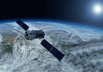
Last week saw India launching its seventh navigation satellite IRNSS-1G, completing its regional navigation satellite system Indian Regional Navigation Satellite System (IRNSS). On this occasion of India being one among world's five countries which has its own GPS and navigation system, Prime Minister Modi praising the achievement christened the service as 'NAVIC' for 'Navigation with Indian Constellation'.
Unlike GPS, GLONASS or BeiDou, INRSS is a regional navigation system with a footprint that extends about 1500 km from India’s landmass. IRNSS is an interesting constellation design of seven satellites with three geostationary satellites (GEOs) (with longitude crossings at 32.5° E, 83° E, and 131.5° E) and four geosynchronous satellites (GSOs) with an inclination of 29 degrees (two each at 55° E and 111.75° E longitude crossings).
This nature of constellation design seems to not only address the navigational requirements for operations across mainland, islands and the Indian ocean but also covers the main sphere of India’s regional security interests’ including China and Pakistan. The design of the constellation also provides an excellent means of reaching out to other SAARC countries for possible extrapolation of Indian receiver system for their public use.
IRNSS is expected to support several services with a positional accuracy of 10-15 metres. Application of IRNSS include terrestrial, aerial and marine navigation, vehicle tracking and fleet management, terrestrial navigation for hikers and travellers, disaster management, integration with mobile phones, mapping and geodetic data capture and visual and voice navigation for drivers.
There is no doubt the strategic importance of having an indigenous navigation system will have an immediate effect in movement towards implanting receiver systems in the armed forces and internal security domain, however, the commercial usage of IRNSS in consumer electronics may be limited. This limitation may be mainly due to the limited footprint of the constellation, given that most consumer electronic goods would want to have a global operational capacity. Nevertheless, there are opportunities depending on the manufacturer on implanting usage of IRNSS in their products. However, exploiting the use of IRNSS shall be a driver for key policy initiatives, while coordinating with Indian Space Research Organisation (ISRO) for implementation.
In order to encourage the penetration of IRNSS in services, the immediate strategy should be to encourage the implementation and usage of IRNSS in the larger domain of public services. This can include central services such as railways and shipping. In addition, States can be encouraged to use IRNSS receivers as a part of their public transportation systems such as buses and emergency services, among others.
Such policy measures shall be key in achieving volumes for manufacturers and service providers to support uses at a cost that is reasonable against that of already flooded GPS receivers. Therefore, a systematic identification of projects under each department and ministry of the government of India and also a charter for usage at various State government levels will ensure that IRNSS usage kicks off with a large scope of integration into major civilian services. This shall put the usage of the navigation constellation on course for commercial/consumer electronics, extension of similar services to other SAARC nations and expansion of the footprint of the constellation in the future.
The views expressed above belong to the author(s). ORF research and analyses now available on Telegram! Click here to access our curated content — blogs, longforms and interviews.


 PREV
PREV


